Rush Peak 2024
© David Hamilton, Oct 2026
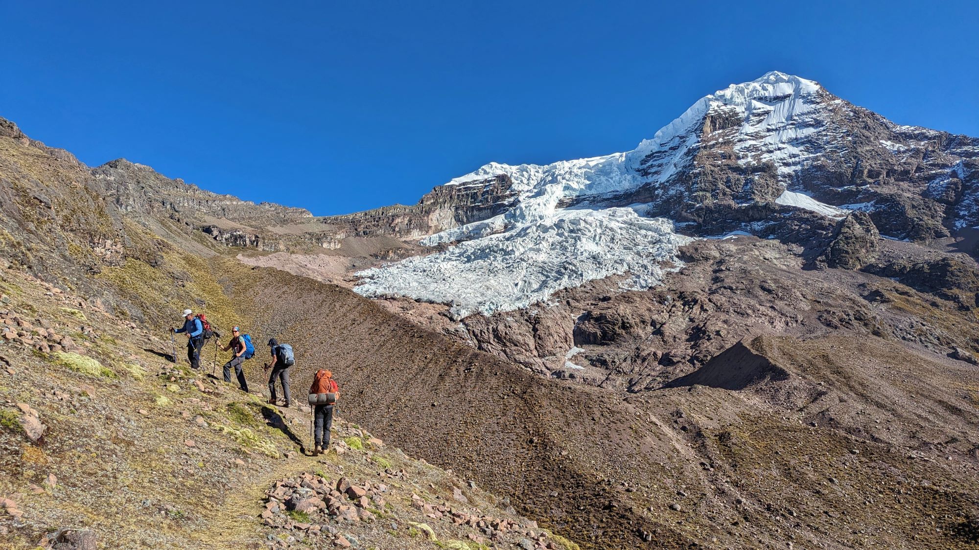
Rest stop on steep climb
© David Hamilton, Oct 2026
More flowers
© David Hamilton, Oct 2026
Approaching Chidin Harai
© David Hamilton, Oct 2026
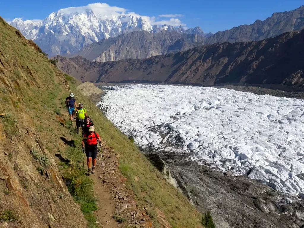
Glacier crossing
© David Hamilton, Oct 2026
Karimabad and Rakaposhi
© David Hamilton, Oct 2026
Hamdar camp
© David Hamilton, Oct 2026
Bull horns
© David Hamilton, Oct 2026
Home comforts
© David Hamilton, Oct 2026
Hunza rainbow
© David Hamilton, Oct 2026
Shija Basa campsite
© David Hamilton, Oct 2026
Rush Peak summit in 2007
© David Hamilton, Oct 2026
Rakaposhi
© David Hamilton, Oct 2026
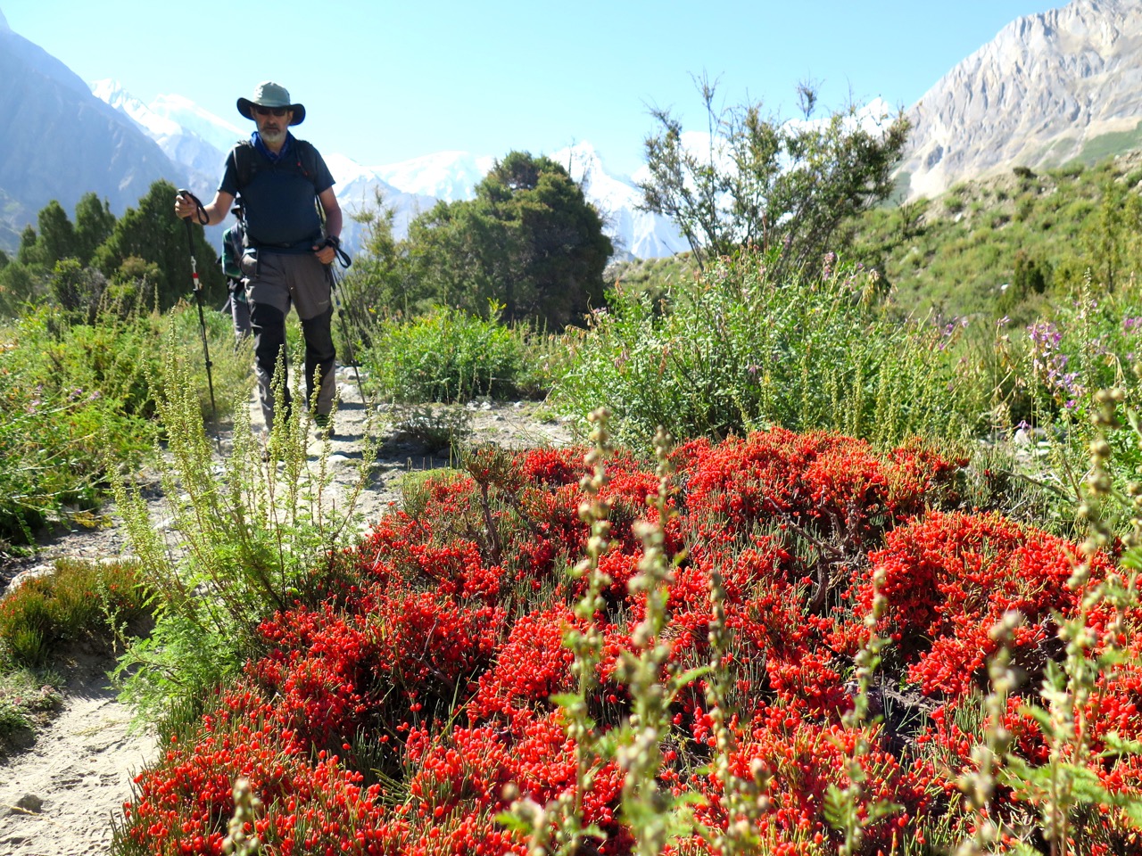
Red berries
© David Hamilton, Oct 2026
Bericho Kor camp
© David Hamilton, Oct 2026
Trek day 2
© David Hamilton, Oct 2026
Trekking by Barpu Glacier
© David Hamilton, Oct 2026
Trek day 4
© David Hamilton, Oct 2026
Shuja Basa camp
© David Hamilton, Oct 2026
Yaks
© David Hamilton, Oct 2026
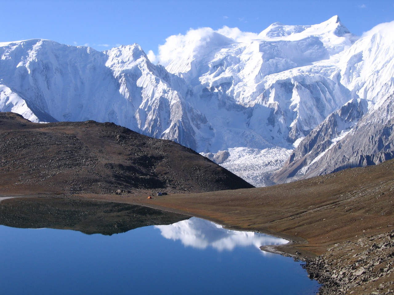
Rush Lake 4660m
© David Hamilton, Oct 2026
Team to Hunza
© David Hamilton, Oct 2026
Spantik base camp
© David Hamilton, Oct 2026
Spantik by day
© David Hamilton, Oct 2026
Rush Peak 5098m
© David Hamilton, Oct 2026
Spantik evening
© David Hamilton, Oct 2026
Leaving Shuja Basa
© David Hamilton, Oct 2026
Porter team at Hopar
© David Hamilton, Oct 2026
North side of the Barpu Glacier
© David Hamilton, Oct 2026
Malubiting Peak
© David Hamilton, Oct 2026
Evening night on Spantik's famous Golden Pillar
© David Hamilton, Oct 2026
Snowfall at Girgindil
© David Hamilton, Oct 2026
Rush Lake in snowy weather
© David Hamilton, Oct 2026
Rakaposhi Peak in the Hunza Valley
© David Hamilton, Oct 2026
Miar Glacier
© David Hamilton, Oct 2026
Looking to the Hispar Pass
© David Hamilton, Oct 2026
Spantik from Hamdar
© David Hamilton, Oct 2026
Bericho Kor
© David Hamilton, Oct 2026
Approaching Rush Peak in snowy conditions
© David Hamilton, Oct 2026
Faisal Mosque in Islamabad
© David Hamilton, Oct 2026
Hamdar campsite
© David Hamilton, Oct 2026
Field Terraces
© David Hamilton, Oct 2026
Trail above the Barpu Glacier
© David Hamilton, Oct 2026
Ultar Peak
© David Hamilton, Oct 2026
Leaving the K2 Hotel in Skardu
© David Hamilton, Oct 2026
Hunza market
© David Hamilton, Oct 2026
Hunza jeep on the KKH
© David Hamilton, Oct 2026
Hopar porters
© David Hamilton, Oct 2026
Hispar peaks
© David Hamilton, Oct 2026
Hillside view
© David Hamilton, Oct 2026
Spantik by evening
© David Hamilton, Oct 2026
Crossing the Barpu Glacier
© David Hamilton, Oct 2026
Chidin Harai
© David Hamilton, Oct 2026
Bualtar Glacier
© David Hamilton, Oct 2026
Baltit Fort Karimabad
© David Hamilton, Oct 2026
Above the Barpu Glacier
© David Hamilton, Oct 2026
Leaving High Camp
© David Hamilton, Oct 2026
About
Highlights
- One of the best short treks in the Karakoram, journeying through a variety of terrain. This trip is unique to Jagged Globe.
- Optional ascent of viewpoint ‘Rush Peak’, with stupendous views of Rakaposhi, Spantik and other Karakoram giants.
- Treks led by experienced Jagged Globe leaders, supported by local guides and porters.
- For reasons of animal welfare, hygiene and changing preferences we do not provide “fresh” meat on our Karakoram treks (other than the first two days, when we can use frozen chicken).
- Safety back up – including Satellite communications, Portable Altitude Chamber (PAC), emergency oxygen for therapeutic use and altitude drugs.
Introduction
This two-week itinerary enables adventurous trekkers to experience some of the best mountain scenery in Pakistan’s dramatic Karakoram Range. The valleys of Hunza are renowned for their friendly people and breathtaking landscape. Snow-covered peaks and precipitous rock spires rise above the irrigation channels and fertile terraced fields. Our trekking route starts from the small farming settlement of Hopar, passes through flower-filled meadows in ablation valleys and involves five glacier crossings as it circumnavigates the Barpu Glacier.
The first part of the trek visits the base camp of Golden Peak (Spantik), located directly below its stunning ‘golden pillar’. The second part of the trek ascends Rush Peak, which rises above Rush Phari Lake on a ridge separating the Hispar and Barpu glaciers. This non-technical 5,098m view point offers one of best mountain panoramas in the Karakoram. Hunza’s high peaks, including Rakaposhi, Diran and Ultar are visible close by. Baintha Brak (The Ogre) and the Hispar La (pass) are visible in the middle distance. On clear days the Baltoro 8,000m peaks (K2, Broad Peak, Gasherbrum) can just be seen far to the east. This is an unforgettable trekking journey showing the best of the Karakoram.

At a glance
- Group Size: 6 – 9 people
- Duration: 16 days
- Difficulty Level: 3
- Maximum altitude: 5,098m

Accommodation & Meals
- 14 Breakfasts
- 11 Lunches
- 12 Dinners
- 1 Hotel Night
- 4 Local Hotel Nights
- 1 Lodge Night
- 8 Tented Nights
Is this trip for you?
If you are considering joining the Rush Peak and Hunza Valley trek you need a good standard of fitness gained from regular mountain walking and be able to walk 6 hours per day on rough terrain carrying an 8Kg pack. Experience of trekking at altitudes over 4,000m is recommended, but not essential.
Still unsure if this trip is for you? Contact our team.
Contact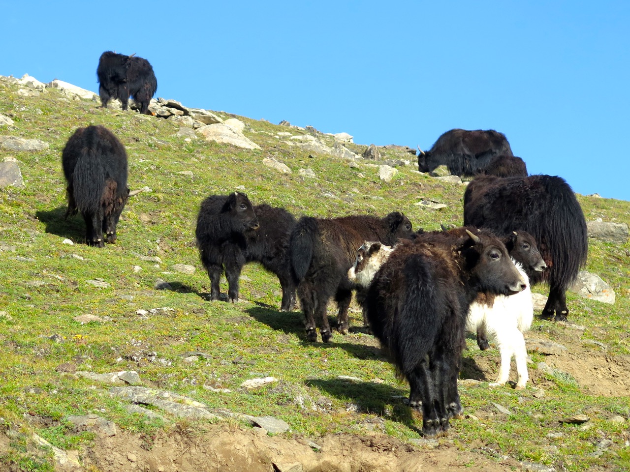

Dates & Prices
Date
Price
Book
Know Before you Go
Jagged Globe supports the British Foreign, Commonwealth & Development Office (FCDO) “Know Before You Go” campaign. We recommend that you read the FDCO Travel Advice for Pakistan on the FCDO Website.
With Flight Pricing
Our “With Flight” price includes an Economy class return airfare from the UK, which we book on your behalf when you book your trek. The earlier you book, the less expensive the airfare and the “With Flight” price tends to be.
What is included in the Trip
- Economy class return airfares from the UK (unless Land Only).
- UK airline taxes.
- Group airport transfers (unless Land Only).
- One in-country, return flight between Islamabad and Skardu by scheduled, fixed-wing aircraft (in the event of bad weather, road transport will be provided).
- 1 nights’ bed and breakfast accommodation in Islamabad on a twin-sharing basis.
- 1 nights’ full-board accommodation in a lodge on a twin-sharing basis.
- 4 nights’ full-board accommodation in local hotels on a twin-sharing basis.
- 8 nights’ full board accommodation in tents on a twin-sharing basis.
- Porterage of group equipment.
- Porterage of team members’ personal clothing and equipment (maximum 12Kg).
- All road transport by private vehicles.
- All costs for a Jagged Globe leader, local guide, cook staff and porters.
- Jagged Globe kitbag or lightweight fleece.
What is not included in the Trip
- Visa fees.
- Overseas airports taxes not paid in advance through the international airline ticket.
- Airport transfers for those joining on a ‘Land Only’ basis.
- Bar bills and laundry.
- Travel insurance.
- Lunch and evening meals in Islamabad.
- Optional trips and sightseeing tours.
- Tips
Itinerary
Download the full Download Now as a PDF.
IMPORTANT NOTE:
Every effort will be made to keep the above itinerary, but as this is adventure travel in a remote mountain region, we cannot guarantee it! Weather conditions, availability of porters and the health of team members can all contribute to changes. Sherpa assistants will try to ensure that the trip runs according to plan, but please be prepared to be flexible if necessary.

Day 1
Fly to Islamabad
International flight from the UK to Islamabad.
Day 2
Arrive Islamabad, fly to Skardu (2,250m)
Those joining on a ‘land only’ basis should arrange their international flight to arrive no later than 04.00hrs today to meet the onward flight to Skardu. Alternatively, you could arrive in Pakistan on ‘Day 1’ and we can book you an additional hotel night – please contact us for prices and booking details.
Day 3
Drive to Karimabad (2,300m)
We drive west on the recently upgraded Indus Highway to the junction of the Indus and Gilgit rivers at Jaglot. Here we turn north onto the Karakoram Highway (KKH) through an arid landscape to the regional capital, Gilgit. Continuing north we reach the green and fertile fields of Hunza dominated by the icy bulk of Rakaposhi. Overnight Hotel. (7-8 hrs). Altitude gain: 50m
Day 4
Sightseeing in Karaimabad (morning) Drive to Hopar (afternoon) (2,850m)
We spend the morning walking around the picturesque streets of the village and visit the historic old fort. After lunch an exciting jeep journey takes us through the fields of the Hunza and Nagir Valleys before the road narrows to a mountain track leading to the roadhead at Hopar where we stay in a simple lodge on the outskirts of the village. Overnight Lodge (90 min drive). Altitude gain: 550m
Day 5
Trek to Hamdar Camp (3,340m)
Porters are assembled to carry our luggage during the trek. Leaving Hopar we cross the Bualter Glacier and trek South East on the grassy hillside high above the Barpu Glacier. After 4 hours we reach the small shepherd’s settlement of Hapukun and one hour later reach Hamdar. (5 hrs). Altitude gain: 490m
Day 6
Trek to Sumayer Bar Camp (3,595m)
The trail crosses an exposed cliff by a cleverly made path and drops down to the edge of the Miar Glacier that takes less than an hour to cross. On the far side we climb into the heavily forested ablation valley and follow this for two hours to reach a lovely campsite surrounded by trees. (5 hrs). Altitude gain: 255m
Day 7
Trek to Girgindil Camp (3,810m)
A short day of trekking over some more difficult ground to reach Girgindil. We follow the wooded Sumayer Bar ablation valley as far as possible before the trail moves onto the Barpu glacier. We cross this by the shortest route to reach the Eastern side and climb up a loose moraine slope to reach the pleasant campsite at Girgindil. (3-4hrs). Altitude gain: 215m
Day 8
Trek to Shuja Basa Camp (4,200m)
The first hour is the most difficult as we negotiate a bulge in the glacier before regaining the ablation valley at Makphon Pari less than a kilometer from Girgindil. From here the trail follows an ascending line (steep in places) over slopes covered in small bushes and trees. It is easy to lose the best line and sometimes the bushes hide the trail. The white ice pinnacles of the Barpu glacier are always visible below and the wall of ice cliffs stretching from Spantik to Malubiting grows larger as we approach it. The campsite of Shuja Basa is located on a level site where two glaciers join and has great views in all directions. (4-5 hrs). Altitude gain: 390m.
Day 9
Rest Day / optional trek to Spantik Base Camp (4,600m)
The start of the route to Spantik base camp is not obvious. A narrow track crosses a very steep hillside for 200m and then a large ‘hidden’ valley opens out giving some of the most pleasant and enjoyable trekking of the whole trip. This undulating terrain leads gently upwards to the campsite used by the small number of expeditions that have attempted Spantik’s Golden Pillar. This remote site is a beautiful spot and is seldom visited by trekkers. (3-5 hr round trip). Altitude gain: 0m (option to walk 400m higher).
Day 10
Trek to Bericho Kor Camp (3,300m)
The longest trekking day of the trip. At the outset it appears to be mostly downhill starting at 4,600m and dropping to 3,300m, but there is quite a lot of up and down involved and it feels like a long day. Several fast flowing streams cut across the path and these have eroded deep gullies that can be tricky to cross. It is also necessary to climb down to the edge of the glacier at a few places, followed by the inevitable climb back up to the ablation valley. The shepherd’s settlement at Chukutans is a great place for a lunch stop and marks the start of a much improved path that runs all the way to Bericho Kor. (7-8 hrs). Altitude loss: 900m
Day 11
Trek to Chidin Harai Camp (4,370m)
If Day 10 is the longest there is no doubt that Day 11 is the steepest. The trail rises in a series of zigzags directly behind camp gaining 700m up a dry and dusty path with few places to stop and rest. The trail leads directly to the crest of the ridge that separates the valley of the Barpu Glacier from the Hispar to the North. The trail turns Southwards and follows the broad crest of this ridge over less steep group for a further 350m to reach the campsite at Chidin Harai (4-5hrs). Altitude gain: 1070m.
Day 12
Ascent of Rush Peak (5,098mm)
An early start is required to get a good chance of clear skies and the best views of the more distant peaks. We start walking at about 06.00hrs and should reach the top about 3 hours later. The trail is easy for most of the way, ascending grass covered slopes and passing along the shores of Rush lake (4,660m). The final 150m of the climb is the only section with any difficulties. The summit cone is composed of large blocks of stone that need to be climbed with care (4-6hrs round trip). Altitude gain: 0m (option to walk 728m higher).
Day 13
Trek to Hoper 2,777m (morning) Drive to Karimabad (afternoon)
The descent to Bericho Kor follows the same path that was climbed on Day 11. The ground is steep and dusty as the path is very ‘direct’ dropping 700m in a very short distance. The route then follows the ablation valley on the East side of the Barpu glacier passing several large flat areas of grassland surrounded by trees. After 2 more hours walking we reach Tagaphari and strike out across the Barpu glacier for the last time. This crossing only takes 30mins and is followed soon after by a crossing of similar length over the Bualter glacier. A final steep climb up a moraine slope leads to the village of Hoper where we have lunch. (5-6 hrs trekking). Altitude loss: 1593m.
Day 14
Drive to Naran
We drive south on the KKH leaving the Hunza valley towards Gilgit. At Jaglot we reach the junction of the Indus and Gilgit rivers. Soon after there are good views of Nanga Parbat (8,126m). The road continues southwards through the rocky barren landscape of Indus Khoistan to reach the town of Chilas. Here we leave the KKH and climb a mountain road to cross the Babusar Pass (4,173m) and descend into the beautiful landscape of the upper Kaghan valley. A few hours later we reach the tourist town of Naran where we spend the night. (9-10 hrs) Overnight Hotel.
Day 15
Drive to Islamabad
The road continues to descend through the forested foothills of the Karakoram to Mansehra where we join the recently constructed motorway for the final stage of the journey to Islamabad (7-8 hrs). Overnight Hotel.
Day 16
Depart Islamabad
Airport transfer. Service ends. For those joining “land-only”, you should book your flight home today.
Essential Info
What is included in the Trip
- Economy class return airfares from the UK (unless Land Only).
- UK airline taxes.
- Group airport transfers (unless Land Only).
- One in-country, return flight between Islamabad and Skardu by scheduled, fixed-wing aircraft (in the event of bad weather, road transport will be provided).
- 1 nights’ bed and breakfast accommodation in Islamabad on a twin-sharing basis.
- 1 nights’ full-board accommodation in a lodge on a twin-sharing basis.
- 4 nights’ full-board accommodation in local hotels on a twin-sharing basis.
- 8 nights’ full board accommodation in tents on a twin-sharing basis.
- Porterage of group equipment.
- Porterage of team members’ personal clothing and equipment (maximum 12Kg).
- All road transport by private vehicles.
- All costs for a Jagged Globe leader, local guide, cook staff and porters.
- Jagged Globe kitbag or lightweight fleece.
What is not included in the Trip
- Visa fees.
- Overseas airports taxes not paid in advance through the international airline ticket.
- Airport transfers for those joining on a ‘Land Only’ basis.
- Bar bills and laundry.
- Travel insurance.
- Lunch and evening meals in Islamabad.
- Optional trips and sightseeing tours.
- Tips
Equipment Hire Service
Certain items of specialist equipment are available for hire from us. All prices are inclusive of VAT (currently 20%)
- 4/5 season sleeping bag (Mountain Equipment and Rab): £75
- Down Jacket Mountain Equipment and Rab: £70
- Ice Axe (single): £20
- Crampons (pair): £20
- Helmet: £15
Our equipment stocks are limited so please reserve your equipment via your on-line account as soon as you know what you need. Payment for hired equipment needs to reach us at the same time as the final balance of your trip.
Please note that we also require a deposit of between £60 – £180, depending on which items you hire.
Jagged Globe Kit Bag
Participants in our expeditions and treks will receive a free kit bag. If you would prefer it, we can supply a lightweight Jagged Globe fleece instead.

Pre-Trip Weekend
Jagged Globe offers pre-trip weekends for all treks, based in Sheffield, UK. The pre-trip weekend provides team members with important information and skills that will enhance their experience of the trip. It is also a chance to meet other team members, should they be attending, as well as giving the opportunity to meet our office team and try on any hire equipment you may need. You can normally attend a pre-trip weekend even if you are not booked onto a trip. It’s a great way of getting more information about a trek that you’re interested in, or just to ‘check out’ Jagged Globe. Contact us about more information on our pre-trip weekends.

Take a look at our latest trip reports
Have you been on this trip? If you’d like to contribute a trip report then we’ll post it up on the site.
Reviews
SwipeLeader Reports
Rush Peak and The Hunza Valley – September 2023
It's easy to have an enjoyable and successful expedition to the mountains when the sun shines every day. Especially in an area of dramatic and beautiful scenery with no other groups present. This is the third time that I have led this trek and each time I have been surprised that this undiscovered gem of a valley has not become more popular with climbers and trekkers.
This trip was designed to showcase some of the diversity of the Karakoram range and delivers on all fronts. Using the increasingly reliable flight to Skardu enables quick access to the mountains, not to mention spectacular views of Nanga Parbat. The improved road network enables easy transport between the districts of Baltistan and Hunza. Thus we were able to visit the rapidly modernising cities of Skardu and Gilgit as well as the historical sights of the Hunza valley. The return road journey to Islamabad gave a chance to travel the full length of the Karakoram Highway, cross the Babusar pass and see the Khagan valley. Entering the lowlands it was possible to see how different the industry and agriculture in Punjab is compared to that in the mountains.
The hiking starts from the sizable farming village of Hopar in the Nager valley, a little to the east of Hunza. Here we were able to see the something of the agricultural life of the region. The grain crops (wheat, barley, millet) were being harvested and the bright orange apricots were spread out to dry in the sun. The village is popular with Pakistani day trippers who come to view the glacier close to the village, but few people trek into the mountains.
The trek is divided into two parts. The first visits the base camp for climbs on the west face of Spantik. Hardly anyone visits this remote location and there have only ever been a couple of attempts to climb the peak from this side. The name Spantik is a Balti word given to the peak by the people of Arandu who live on the east side of the mountain. The Hunza and Nagar people call the peak Ghenish Chhish and this is widely translated as Golden Peak. The daily distances on this trek are not large, however the trails are rarely used and often indistinct so progress can be slow. Many sections of the trail are easy and pleasant following ablation valleys through a landscape of trees, bushes and flower filled meadows. But other sections cross rocky scree slopes or boulder fields. The most difficult sections of the route are the multiple glacier crossings. These are ‘dry’ glaciers of hard ice often covered with a layer of small stones requiring careful footwork. The natural campsites all feature large level areas of grass close to good watersources. In most cases there were almost no signs of previous visitors. Of the 20 local porters accompanying us only two had visited this area before, even though it was only a few days walk from their village.
On arrival at Spantik base camp we were greeted by a large open meadow carpeted in a large variety of wildflowers. We had been keen to see wild ibex and Marco Polo sheep. However these elusive animals are adept at keeping out of sight and we had to satisfy ourselves with seeing tracks on the ground and faint trails on distant hillsides. Our outward journey had mostly been on the west side of the Barpu and Sumayer Bar glaciers. We started our return trip on the eastern side using a different trail and visiting new camping spots.
The second part of the trek climbs high above the glaciers to visit Rush Lake and climb Rush Peak. This gives bird’s eye views of the landscape that we had travelled through in the previous days. This is a more popular trekking destination and for the first time we met a few other hikers. We were glad to have made an early start for the steep climb out of the valley floor and reached the campsite at Chidin Harai before the arrival of the afternoon heat. The following morning we climbed past a large herd of yaks grazing by the shores of Rusk Lake (4,694m). This is said to be the highest alpine lake in Pakistan. Shortly after we were on the final rocky slopes leading to the summit of Rush Peak (5.098m). The weather was fine and sunny for the ascent but for almost the first time on the whole trip the sky was not perfectly clear. Several clouds were sitting on the tops of mountains in the middle and far distance. While it was possible to identify most of the nearest mountains it was not possible to see the further peaks such as k2 and the other Baltoro 8000m peaks.
Pakistan does very little to promote itself as an adventure tourism destination. It would be fair to say that the government has other priorities and is content to leave the field for private tour operators to develop. In Western counties Pakistan is more often likely to feature in the news due to natural disasters or political upheavals. It is rarely thought of as a tourist destination. When we had our post trek debrief some members of this trek group confessed to having had some reservations about visiting Pakistan before traveling. But when we talked through the details of the trip the comments were:
- Overall the trip met or exceeded expectations in every regard.
- The general friendliness and welcome from the Pakistani people was better than expected.
- The roads were much better than expected: ‘the road surface on the Karakoram Highway is better than the M6!’
- The vehicles were more comfortable than expected.
- The hotels were better than expected.
- The standard of food was better than expected: in hotels, in restaurants and on the trek
- The scenery was better than expected: especially the variety and quantity of wild flowers in the grass meadows
- The local staff were more welcoming and helpful than expected.
- We managed to pack a lot into 2 weeks and it felt that we had been away on a much longer trip.
It was also said that the difficult parts of the trail were more challenging than people had expected and I promised to update the notes for future trips to emphasise the fact that you need to be confident of your footwork on difficult terrain to enjoy this trek.
As I said in the first words above, the sun did shine every day, which is a bit of a shock for most people from the UK. So perhaps if it had rained a lot the team might not have given such a glowing appraisal.
Travelling to and from Pakistan, getting to the mountains and back (by two different routes), and achieving a significant trek all in 2 weeks from the UK is always going to present a few challenges. However the travel all plans worked well from domestic flights to several road journeys. The team achieved everything in the planned itinerary without ever feeling stressed or rushed.
Thanks to the following without whose efforts this trip would not have been possible:
Ghulam Mohammad for his assistance navigating the rather daunting Pakistan Visa application process.
Manzoor Hussain : Hunza resident, and professional driver. Owner of a ‘classic’ red Willys jeep and a Toyota HiAce minibus (set up with 8 comfortable seats rather than the normal 12). He provided all the road transport for the group was also ‘guide’ for the group on the road journey from Hunza to Islamabad at the end of the trip.
Mohammad Sharif & Rizwan Ali: trek guides (plus Sharif’s son Sarfraz who providied an additional vehicle to transport supplies and staff between Skardu and Hunza)
Jamil: cook
Jaffar (sirdar of the Hopar porters) and the 20 Hopar porters who carried all the group kit for the duration of the trek
And finally to the team (Bob, Gill, James & Hilary) for their positive attitudes and good humour throughout
Rush Peak and The Hunza Valley – September 2008

All six expedition members reached the summit of Rush Peak on Tuesday 9th September. Conditions underfoot were worse than expected due to a thick covering of snow on the normally rocky slopes. The weather was fine for most of the expedition, but heavy snowfall on 6th September left deep deposits above 4000m. This prevented the team from reaching Golden Peak (Spantik) Base Camp as planned on the 7th. Instead they climbed Rush Peak a day ahead of schedule in reasonable weather. Ever changing cloud formations prevented views of the more distant peaks that can normally be seen from the summit.
This expedition managed to achieve a lot in a short period of time. Transport connections worked well and a combination of domestic flights and jeep travel on mountain roads saw the team ready to start trekking 4 days after leaving the UK even after a leisurely afternoon of sightseeing in Islamabad and another in the Hunza valley.
All the equipment needed had been left in the Hunza valley by the Jagged Globe expedition to Muztag Ata (Western China) that had travelled on the Karakoram Highway the previous week. While the group had a guided tour of Karimabad from Manzoor, our local contact, the expedition leader, cook and guide went shopping for provisions in the local market. The Baltit Inn provided a very comfortable place to recover from the journey and several of the group compared it to Kathmandu’s Summit Hotel.
A short ride in open top jeeps took the group to Hopar (2825m) where they had a relaxed afternoon watching the local farmers harvesting their crops using techniques that have remained unchanged for centuries. The following day they set off on the three day trek along the southern side of Barpu Glacier. There was a good path for most of the way, but the route became more exciting on the three obligatory glacier crossings. The campsites were all grass covered and the team noted that this was one of the few treks in the Karakoram where tent pegs could be used. Views of Spantik’s ‘Golden Pillar’ dominated this section of the trek. The colours were quite washed out in the morning as the sun rose behind the peak, but contrast increased in the evening and the eponymous golden hues emerged.
At this point cloud turned to rain, and rain quickly turned to snow. The campsite of Girgindil (3800m) that had been grass on arrival was under 20cm of snow 36 hrs later. It would have been difficult and dangerous to climb 1000m higher to Spantik Base camp, so the team chose to lose height in the hope of finding better weather. This gave them the chance to climb onto the ridge separating the Hispar and Barpu valleys one day ahead of schedule. From a camp at 4360m they set off to climb Rush Peak on 9th September. The climb typically takes 3 hours in good conditions when the trail is entirely on rock and scree. With a deep covering of snow the team took 4.5 hours arriving on the summit at 13.00 following a 08.30 start. The best maps of the area give a summit height of 5,098m but GPS readings gave a height 5,046m, which is probably more accurate.
Returning from the summit the trek continued its leisurely pace with two more short days walking required to reach Hopar before onward travel via Hunza and Gilgit to Islamabad for International flights home.
The team all agreed that the expedition had given a great opportunity to enjoy dramatic Himalayan landscapes in a short trip. The friendly, enthusiastic and hard working local staff added an extra dimension to the experience. Heavy snowfall forced a slight change of itinerary but did not adversely effect anyone’s enjoyment of the programme.
Rush Rush Peak and The Hunza Valley – September 2007

The town of Skardu in Northern Pakistan is the centre of Jagged Globe’s operations in the Karakoram. On August 28th I waved goodbye to Mungo Ross and his team of 8 climbers as they departed the K2 hotel for Cathedral Peak. After the rush of preparing the supplies for this group I had most of the day free to check the equipment recently returned from the Muztag Ata expedition and the July and August K2 Base Camp Treks.
The following day I left for Hunza leading possibly the smallest Jagged Globe expedition of 2007. My partner Claire, myself, plus local guide Sharif and cook Ali easily fitted into a single Toyota Landcruiser with our luggage for the 10 hour drive to Hunza. We spent a pleasant evening in Karimabad, the historic capital of the Hunza Valley. This wonderfully situated town is the most popular tourist attraction in Northern Pakistan, yet remains virtually undiscovered compared to similar towns in neighbouring India and Nepal. The 600 year old Baltit Fort dominates the valley and is probably the most photographed building in the Karakoram. On the other side of the valley the snow covered peaks of Diran (7,266m) and Rakaposhi (7,788m) rise dramatically above the terraced fields.
Next morning we left Karimabad in the company of Manzoor, a local jeep driver I have known for 20 years since my first journey to the Karakoram. In those days his father ran one of the first simple tourist hotels in the area. There are now more than a dozen good quality hotels in Karimabad, but the post 9/11 downturn in tourism means that they are rarely more than half full and good rooms can be had for very reasonable prices. The drive to Hopar took only one and half hours in the open top jeep – and will take even less when the new road is completed. Along the way we saw farmers collecting in the late season crops, while on the rooftops flat round trays of apricots were drying in the sun.
There are two simple hotels in Hopar. Manzoor recommended the Hopar Hilton, which at under £5 per night has to be one of the least expensive Hilton Hotels in the world. Complex negotiations were needed to understand the complexities of the local porter system, but next morning 5 porters were ready to carry our loads – plus 2 more to carry the food for the porters for the next 10 days.
Rush Peak is becoming a popular 4-5 day trek. However the rapid ascent profile means that many people attempting it without prior acclimatisation struggle. The trek to the Base Camp at the foot of Spantik’s Golden Pillar is rarely attempted and is a great 5 day trek in its own right. Our plan was to create a 10 day programme that started with a trek to Spantik BC and ended with an ascent of Rush Peak. In the process we would circumnavigate the Barpu Glacier, trekking outwards on the West bank and returning along the East bank.
One unique feature of the glaciers near Hopar village is that they reach down to very low altitudes in the valleys. The Barpu and Bualter glaciers descend as low as 2,600m making them possibly the lowest glaciers in the Himalayas. So it is possible to trek in a landscape dominated by these huge rivers of ice without reaching very high altitudes.
The trek started from Hopar (2,850m) and climbed down a steep track to the Bualter Glacier 200m lower. We crossed this in 30 minutes via a fairly straightforward path. Our plan envisaged 5 glacier crossings during the 10 day trek. In the end we did the 5 planned crossings plus 2 excursions onto the Upper Barpu Glacier on the way to Spantik BC. Most of the trek on day one followed a faint hillside path high above the Barpu Glacier on the way to a few small huts at Hamdar. Here we found clear running water, a grassy spot to pitch the tent on, several hundred sheep, and a lone shepherd making butter by hand in a traditional wooden churn. Typical for the terrain in this area the campsite perched on small path of level ground on a hillside overlooking a broad expanse of glacial ice several hundred meters bellow.
The next day we made an early start following the hillside above the glacier in a South East direction. Soon the hill became a steep cliff and the path changed into a narrow man made ledge. This had been carefully constructed from rocks supported by tree trunks driven into the cliff face ago by past generations to give access to grazing pastures close to the Miar Glacier. We dropped to the edge of this glacier and crossed the bare white ice to reach the forested ablation valley known locally as Sumayer Bar. This heavily wooded area continued for over 3km and we camped in a clearing next to some shepherds’ huts about midway along. The following morning was again clear and there were great views of Spantik standing at the end of the valley. Reaching the end of the wooded area we struck out across the Upper Barpu glacier to reach its East bank. This crossing was trickier than the 2 previous, involving sections of loose stones as well as dirty black ice and took 90 minutes. Soon we were erecting out tents at another idyllic site overlooking peaks and glaciers known locally as Girgindil. We were now above the tree line and the vegetation consisted of dense bushes about 1m high that covered to hillsides surrounding camp. Autumn has well and truly arrived at this altitude and many of the bushes had turned golden shades of orange and yellow, looking particularly dramatic in the evening sunlight.
An unexpected diversion onto the glacier the next day added an extra twist to the trek and marked the start of an area unknown to most of our porters. Opinions on the length of the day, the availability of water and the location of our intended campsite varied. Eventually 4 hours of pleasant, and sometimes steep, trekking took us to Shuja Basa where the glacier from Spantik joined the main flow of the Barpu glacier originating in the icefields of Malubiting’s North face. For 4 days we had trekked for 3-4 hours each morning reaching camp by lunchtime and leaving the afternoons free. On the fifth day we gave the porters a rest and for the first time did not move camp. Instead we climbed into a wide attractive ‘hidden’ valley and after 2 hours reached the 4,650m site of Spantik Base Camp.
Only a handful of expeditions have used this site since the British pair of Mick Fowler and Vic Saunders made their groundbreaking ascent of Spantik’s Golden Pillar in 198x. Few trekkers venture this far up the Barpu Valley and the area was thankfully free of the rubbish that pollutes many of the more popular trekking areas in the Himalayas. Sadly there was quite a bit of low cloud obscuring the peaks above 6,000m and we were denied the close up view of Spantik that we had hoped for. There were fresh footprints of Ibex in the muddy streambed, but we scanned the hillsides vainly searching for a sighting of these elusive animals.
With the first part of the trek over it was time to turn northwards following the East bank of the Barpu glacier, dropping a lot of height on the way to our next campsite at Bericho Kor. This was the longest day of the trek and we covered three and a half ‘porter stages’ in 6 hours walking. First we retraced the route to Girgindil taking 2 hours to descend what had taken 4 hours to ascend. This despite time lost when our porters tried to bully a reluctant group of yaks to follow them down a precipitous cliff onto the glacier. A nice lunch spot was ignored at Chukutans where the porters spent quite a bit of time trying to commandeer two donkeys to carry their loads for the remainder of the day; one load stayed on, the other repeatedly fell off. From this point the path improved considerably and the terrain in the afternoon was much easier, although the temperatures became warmer as we dropped to lower altitudes and lost the cooling breeze from the glacier. At Bericho Kor the campsite was in a grove tall trees and we welcomed the shade they gave from the hot sun. The small stream was pleasantly warm and ideal for a much needed wash. We had brought sufficient food and fuel for the entire 10 day journey, but the porters had either brought insufficient supplies for themselves, or had been eating more than anticipated and now their supplies were running low. Two porters therefore made the round trip to Hopar in the middle of the night to fetch extra provisions.
The nature of the trek changed considerably the next day with an unrelenting 1100m climb up a steep and dusty path to Chindin Harai. This camp is situated on the broad ridge separating the Barpu valley from the Hispar valley to the north. In former times the lands atop this ridge were used for grazing. Abandoned shepherds’ huts and water channels remain. In recent years changing rainfall patterns and easier forms of income in the valleys have led to these marginal lands being abandoned. The ridge provides a fantastic vantage point from which to view the surrounding high mountains. The ridge running from NW to SE contains a number of shallow depressions, rounded hilltops and sharp pinnacles. Chidin Harai at a height of 4,366m offers a sheltered camping spot with a year round water source. A little more than an hour above, at a height of 4,662m lie the clear blue waters of Rush Lake framed by a ring of snow covered peaks. There are few vantage points in the Karakoram reachable by straightforward hikes that afford such dramatic views of the surrounding peaks.
To the North lie the Hunza Peaks dominated by Ultar (7,388m). In the West Rakaposhi (7,788m) and Diran (7,266m) occupy the middle distance, while several seldom seen peaks of snow and ice fill the skyline to the Southwest: Miar (6,824m), Phuparash (6,574m), Malubiting (7,458), and Spantik (7,027m). The horizon to the East is filled with the chain of peaks separating the Hispar and Shimshal valleys including Lupgar Sar (7,200m), Momhil Sar (7,343m), Trivor (7,728m), Mulunguti Sar (7,025m), Distaghil Sar (7,885m) and Kunyang Chish (7,852m). Perhaps the best viewpoint in the locality is the rocky outcrop known as Rush Peak. This is about 2 hours above the waters of the lake. For one and half hours the trail crosses fairly gentle terrain made up of grassy tussocks and stones, before the final 30 minute climb over steep loose boulders. All the published maps give a summit height of 5,098m and I do not know how or when this was surveyed. My GPS gave a reading of 5,040m, so perhaps some further work is needed to determine the true height or perhaps the rock is so loose that 48m has fallen form the summit in recent years.
From the rocky summit there is a clear line of sight East to the 5151mHispar Pass at the junction of the Hispar and Biafo glaciers. On a clear day the peaks of Baintha Brakk / The Ogre (7,285m) and Latok (7145m) can be seen on the far side of the pass. It is said that K2 can be seen in the far distance, but this requires perfect weather conditions. Even with binoculars I could only vaguely identify the very hazy shape of a large triangle in the far distance and could not say for certain if it was K2.
We actually climbed to the summit of Rush Peak twice. On September 7th a thin layer of fresh snow lay on the ground. This was good for photographs but made the climb to the summit tricky. And when we got there low cloud obscured the more distant peaks. We returned the following day, leaving camp a little earlier, to beat the daily build up of clouds. All the new snow had vanished and the views were considerably better. This left us with a long descent, back to camp at Chidin Harai 680m below, and then on to Bericho Kor a further 1100m lower.
The drop in altitude resulted in a dramatic rise in temperature and we spent a pleasant afternoon relaxing in the shade of evergreen trees and washing in the small stream running through camp. The porters were now looking forward to the end of the trip and a return to their village. They spent hours washing their clothes and themselves and ended up looking much cleaner than us. The final day of the trek saw us cover the distance back to Hopar quickly. There was a good path down the wide ablation valley and flat areas of grass alternated with patches of trees and rocky sections. We passed several shepherds driving their flocks of sheep and goats back to the village before the onset of the cold weather marking the end of summer. The final two glacier crossings were easy and we crossed the Barpu and Bualter glaciers in 30 minutes each. It only remained to climb the steep slope of dried mud 200m from the glacier bed to the village. The first village at the top of the hill was the Hopar Hilton and we treated ourselves and the porters to a celebratory bottle of Pepsi (the strongest drink available). At least the bar bills were reasonable, and 11 bottles of Pepsi only set the budget back £2.50.
Although I have trekked and climbed in much of the Karakoram the Barpu glacier was new to me. The experience on this trek confirmed my belief that this is the best place in the Karakoram for a ‘short trek’. Access is relatively quick and easy, the scenery spectacular, and the trekking varied and interesting. The reconnaissance trip was a very enjoyable end to my 2007 Karakoram season. I learnt a lot of helpful details that will be fed into planning the 2008 Jagged Globe trip to this area, and Sharif, who will be working with the trip next year made several good local contacts.
Sorry, no trip extensions found.
There are no extensions for this trip at the moment. Please check back at a later date.